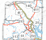
Etowah Valley Historical Society (EVHS) Map Gallery
EVHS is pleased to offer a selection of interactive historical maps that are cursor sensitive to zoom, direction and text rich information for plotted points. Each county map focuses on a themed topic. SEE MORE MAPS
[wpcol_1quarter id=”” class=”” style=””]
[/wpcol_1quarter] [wpcol_1quarter id=”” class=”” style=””]
[/wpcol_1quarter] [wpcol_1quarter id=”” class=”” style=””]
[/wpcol_1quarter] [wpcol_1quarter_end id=”” class=”” style=””]
[/wpcol_1quarter_end]
[wpcol_1quarter id=”” class=”” style=””]
[/wpcol_1quarter] [wpcol_1quarter id=”” class=”” style=””]
[/wpcol_1quarter] [wpcol_1quarter id=”” class=”” style=””]
[/wpcol_1quarter] [wpcol_1quarter_end id=”” class=”” style=””]
[/wpcol_1quarter_end]
This map Gallery has been created with the coordination of Bartow County GIS office and members of the EVHS team. It is an every-growing project that will continue to produce new data and interesting information for the public. Please let us know if you experience any problems, have questions, or ideas about the map gallery at:waitsj@bartowga.org.
NOTE: Many of these maps are under construction.
More maps are available at: Bartow County GIS Map Gallery
