1835 Treaty of New Echota – Signed in Old Cass County, Georgia
By Joe F. Head
A forgotten History of the Cherokee Capitol and Removal in Cass County
Local Native American history often takes a back seat to the average awareness of Bartow citizens. Perhaps the most well-known event regarding Native American history in the Peach State is the 1838 – 1839 removal of the Cherokee Nation from northwest Georgia. This expulsion became known as the “Trail of Tears.” Even fewer realize that old Bartow’s footprint (Cass County) included New Echota at the time of the Treaty.
However, most people only think of the Cherokee people as the affected population that was relocated to Indian Territory in Tahlequah, Oklahoma. In fact, there were five federally recognized tribes that were herded out of the southeast to Indian Territory.
The Cherokee were the last and largest Indian Nation to be relocated, estimated at 17,000 men, women, and children with approximately 6000 dying along the trail. However, removal also included the Seminoles, Chickasaw, Choctaw, and Creek. The cumulative trail distances, depending on the origin, actual foot paths, journey obstacles, and the winding trails taken by
the various 5 tribes, amounted to 5000+ miles. Origins began in North Carolina through Tennessee, Georgia, Alabama, Kentucky, Illinois, Arkansas and Missouri, all destined to reach Indian Territory in Oklahoma.
The Cherokee assimilated well into the customs and political systems of their white counter parts. As the threat of removal increased, the Cherokee appealed their case to US Chief Justice John Marshall in 1832. Marshall ruled in favor of the Cherokee and declared they were a sovereign Nation and could hold land. Soon after, President Andrew Jackson dismissed the ruling.
According to David Gomez, Manager of New Echota Historic Site in Calhoun, “Echota was the ‘only’ Capitol ever established east of the Mississippi River. Councils started meeting here in 1819 and the Capitol of New Echota was established in 1825 and the 1st Constitution was written here in 1827.”
“There were several important principal towns during the colonial period. A town called Chota was located up in what is now TN and is under water today (TVA reservoir) and New Echota was named for Chota’s importance. “
Cass County’s original 1832 northern boundary extended north to the Coosawattee River. The Cherokee capitol of New Echota existed at this time and was located just south of the confluence of the Oostanaula and Coosawattee Rivers (east of present day I – 75)
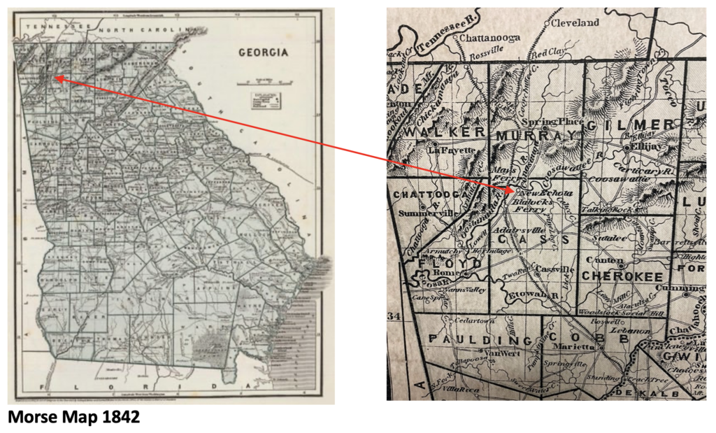
These borders place New Echota in old Cass County’s boundaries at the time of the 1835 Treaty. However, in 1850 Cass County and Murray County were repartitioned to create Gordon County. Cass County’s northern border was moved south just above present – day Adairsville. At the start of the Civil War, Cass County was renamed Bartow in 1861, honoring the first Confederate officer (Colonel Francis Bartow) killed in the war at the first Battle of Manassas.
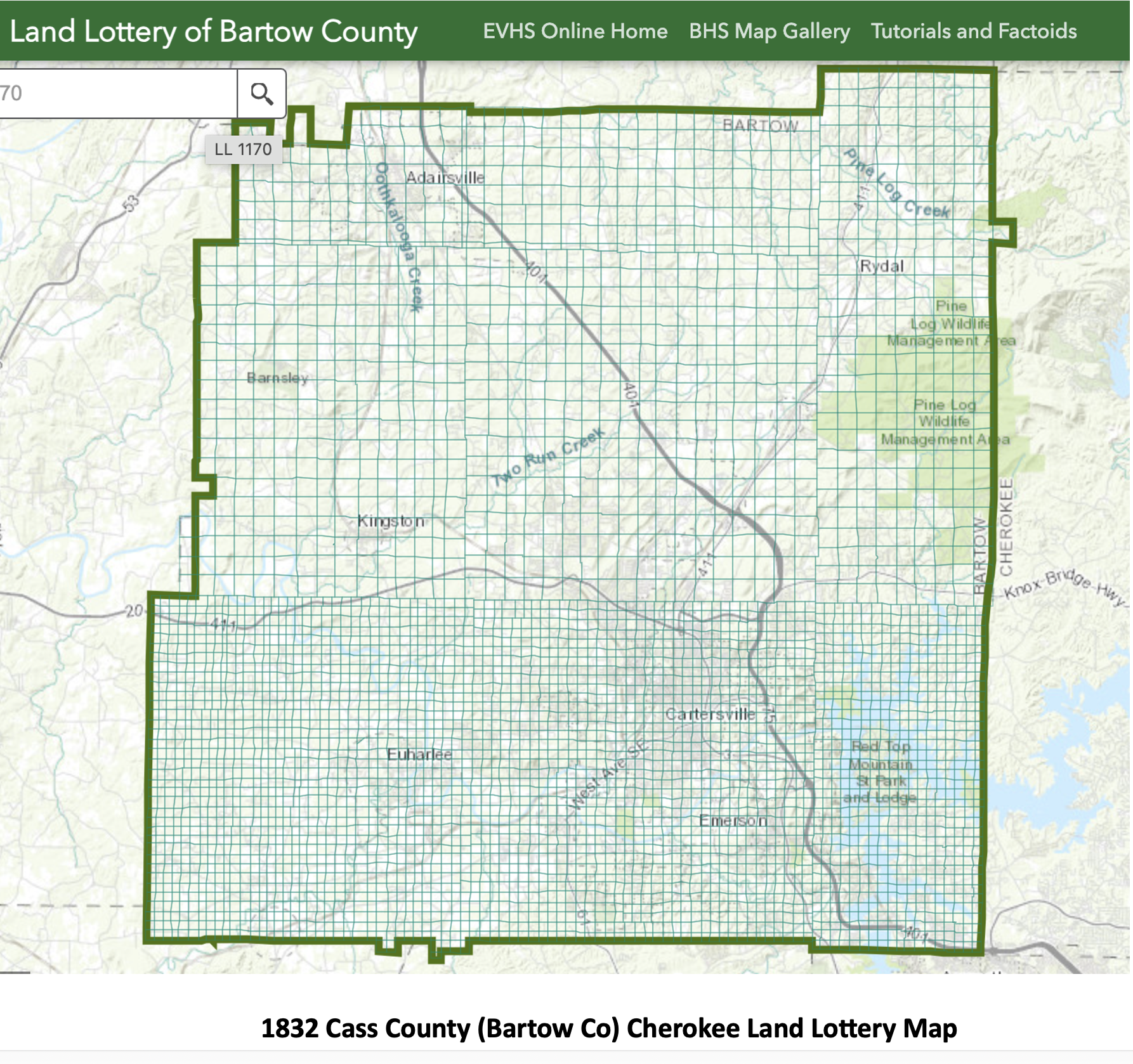
Georgia began land lotteries in 1805 awarding parcels to white male settlers. However, America’s first gold rush began in north Georgia (Dahlonega) in 1828 making it a bonanza of interest. Gold fever drew thousands of prospectors and settlers who were interested in farming, land speculation, timber, and climate. Cass County (later Bartow County) was established in 1832 when the massive Cherokee region was divided into smaller counties. Once gold was discovered, Georgia held what became known as the Cherokee Land Lottery. To accommodate the demand, Cass County structured a grid of 160 acre agricultural lots vs 40 acre gold lots.
The smaller lots were surveyed as a block in the southern half of Cass County to allow more opportunity and parity for recipients to discover gold. Once gold prospecting began, Cass County was discovered to hold an immense wealth of other mineable ores, primarily iron. This motivated further interest and a desire to accelerate the Cherokee removal.
The removal process involved moving Native Americans to temporary holding sites that were referred to as stockades, posts and forts. The Cherokee from Cass were taken to Fort Means located west of Kingston on the north side of the Etowah River (AKA Hightower River) and likely south of today’s Highway 293 just inside the Floyd County line adjacent to Reynolds Bend Road.
Records reflect that there were 467+ Cherokee contained at this location. The fort was named for Captain John F. Means who commanded one mounted Georgia Militia company of approximately 70 men. By April 1838 soldiers began building the stockade. Construction included felling trees, digging ditches to erect log walls, clearing brush, hospital, constructing pickets, block house, store houses and stables. Documents reveal it was in operation for less than a year. Once the gatherings were complete, the Cherokee were marched to Ross’s Landing (Chattanooga) and transported west to Indian Territory.
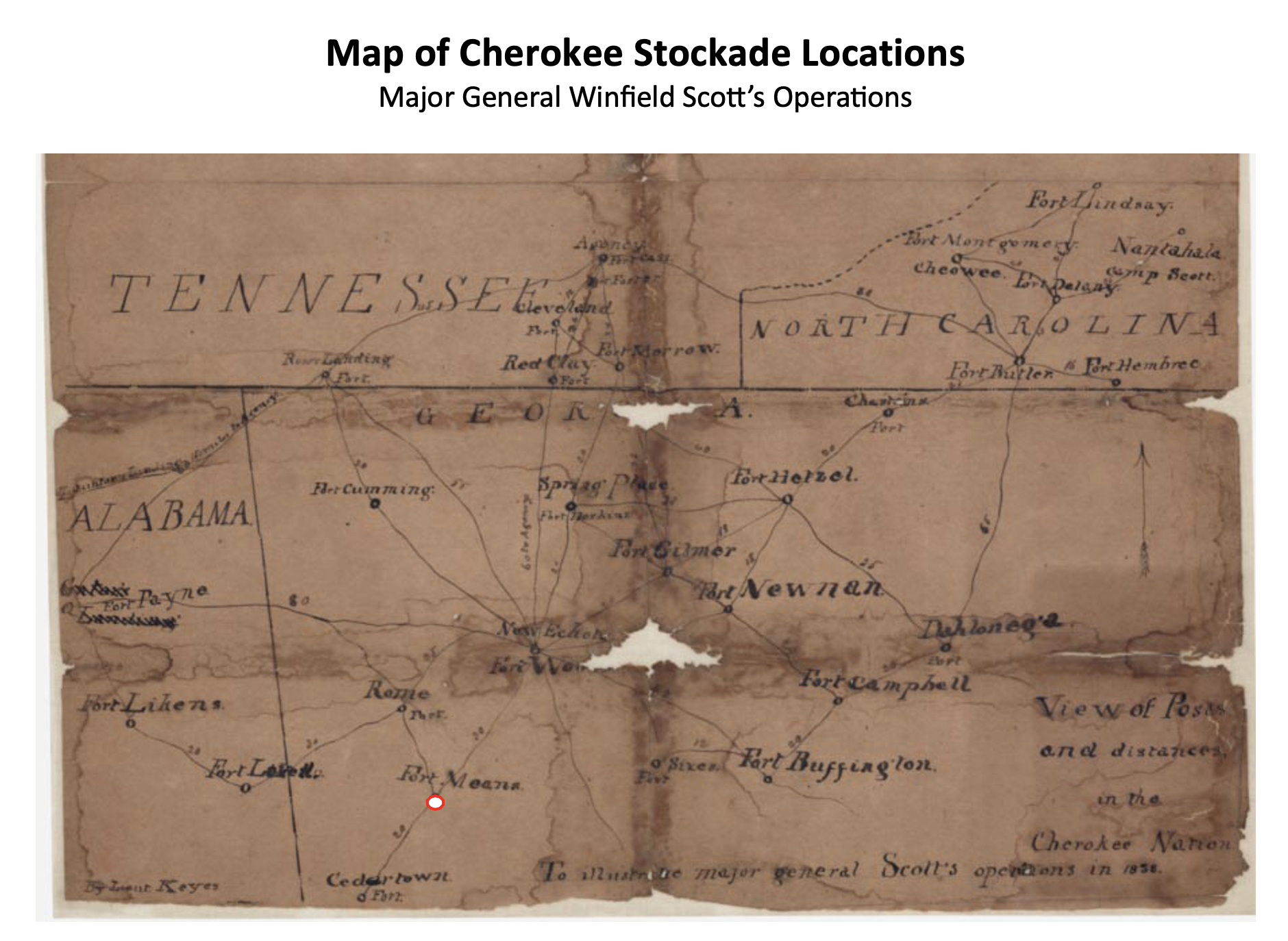
Approximate location of Fort Means noted above southeast of Rome
View of Posts & Distances in the Cherokee nation, to illustrate Maj. General Scott’s operations, December 15, 1838. Map by Lt. Erasmus Darwin Keyes, approximating the locations of and distances between removal posts in the Cherokee Nation. Courtesy of the U.S. National Archives and Records Administration.
(An excellent article regarding the Cherokee removal referencing Fort Means is available on-line by Sarah Hill, February 20, 2017)
Summary:
In closure, there are many subtle historical moments in Cass/Bartow County history that have yet to be discovered. Most are overlooked, forgotten or may never be unearthed. This observation is intended to recover one of those faded treasures that rightfully belongs in the archives of Bartow’s heritage.
Bibliography
Internet Sources:
Removal, W. J. Bishop, https://trailofthetrail.blogspot.com/2009/09/removal.html
All Roads Led From Rome: Facing the History of Cherokee Expulsion, Southern Spaces, Emory University, Digital Scholarship, Sarah Hill – https://southernspaces.org/2017/all-roads-led-rome-facing-history-cherokee-expulsion/
Cherokee Removal from Georgia : Sarah Hill, Final Report, December pp 70 -73 https://www.nps.gov/trte/learn/historyculture/upload/Cherokee-Removal-from-Georgia-508.pdf
The Trail of Tears, Points Along the Trail, https://www.researchonline.net/removal/point1.htm
Interviews and Consultations
Archer, David, February 9, 2024, Former Cartersville City Attorney
Gomez, David, July 28-29, 2023, Manager of New Echota Historic Site (Calhoun, GA)
Posey, Brad, February 7, 2024, Local historian and field researcher (Kingston, GA)
Articles, Books, Pamphlets
The Curious Disappearance of Fort Buffington Cherokee County 1838 – 2019, Larry Vogt
Maps
Morse Map, 1842
Cass County Land Lottery Map, Etowah Valley Historical Society
https://evhsonline.maps.arcgis.com/apps/webappviewer/index.html?id=292c47854dd44513b9adbc69a2b08783
Cherokee Removal Stockade Sites, December 15, 1838. Map by Lt. Erasmus Darwin Keyes,
U.S. National Archives and Records Administration.
